Beautiful 8-Acre Lot in Berkeley County, South Carolina
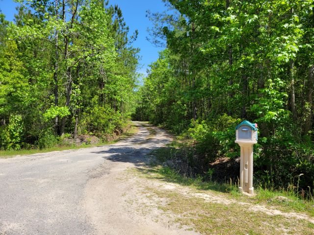
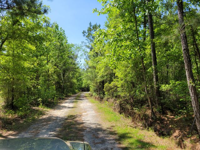
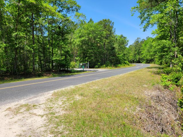
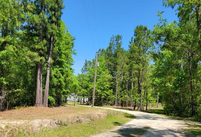
The property is located in St. Stephen, a town in Berkeley County, South Carolina. It is surrounded by heavy trees and a secluded lot off of Betaw Rd. If you’re looking for a single-family detached or any residential uses, this is the place, it’s peaceful and a great chance to build any recreational and amusement ventures and still be close enough to town where you can get what you need from the local stores and markets.
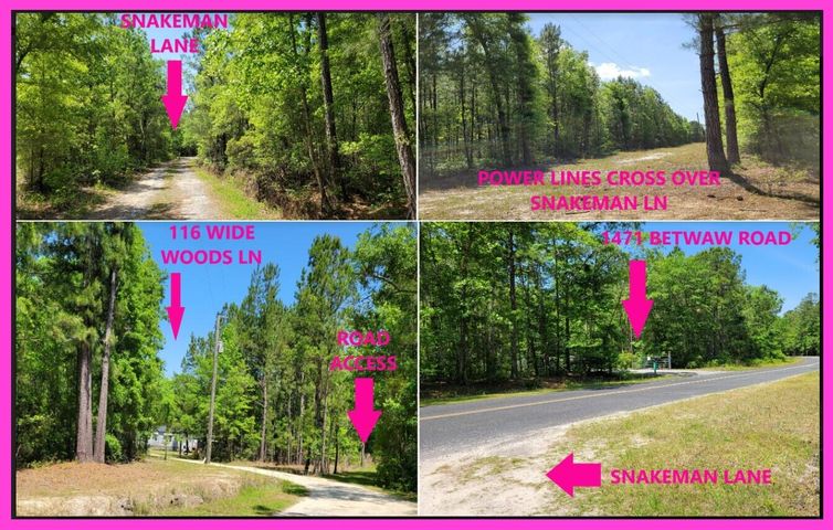
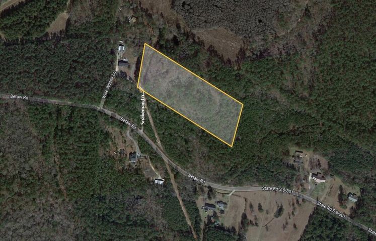
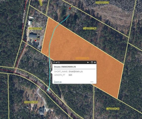
The 8-acre lot has a rectangular shape and has a road connected to the main road about a couple of hundred yards where power lines are close by, and they’re connected to electric poles in the street’s corners, with electric wires running through the area’s dense trees. Gas and water can also be easily accessed.
Some non-commercial structures are also permitted such as publicly owned/operated parks/playgrounds, churches, public schools, golf courses, home occupations, and more.
The property is not in a flood zone.
OWNER FINANCING IS AVAILABLE!
For more information, email us at buyers@cjhland.com or call us at (919) 648 2186
BUY NOW! – $115,000
Property Information
Parcel Size
8 Acres
State
South Carolina
County
Berkeley County
Property Zoning
Agricultural (Flex-1)
Parcel #
037-00-03-048
Subdivision
Not Stated
Power lines are nearby Power
SEPTIC No Data
NO WATERFRONT
33°23’06.9″N 79°52’44.5″W COORDINATES (CENTER)
None HOA
65.62 ft – 82.02 ft Elevation
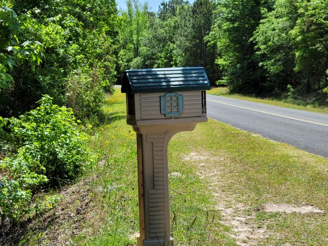
0 Snakeman Lane, Saint Stephen, SC 29479 FULL ADDRESS
1. 33°23’10.7″N 79°52’47.9″W
2. 33°23’07.1″N 79°52’48.9″W
3. 33°23’02.1″N 79°52’39.4″W
4. 33°23’05.7″N 79°52’38.5″W
4 CORNER COORDINATES
$25.08 ANNUAL TAXES
Additional Information
Shape of Property: Parallelogram
Flood zone: No
Superfund zone: Not in superfund zone
View: Heavy Trees
Permitted uses. The following uses are permitted within the Flex1 agricultural district:
A.Agricultural uses.
Agriculture, crop.
Agriculture, home animal production.
Agriculture, home horses.
Forestry.
B.Recreation and amusement uses.
Ecotourism.
Golf course.
Indoor recreation.
Outdoor recreation, active.
Outdoor recreation, passive.
C.Institutional uses.
Assembly and worship
College and professional schools.
School, neighborhood and community.
Government office, public services, and local utilities.
D.Residential uses.
Single-family detached.
Duplex (residential, two-family).
Manufactured home.
Visiting the Property: You are welcome to visit the property at your convenience while it is available. Please see information regarding the coordinates aboveNot in superfund zone